In May 2017, after initial plans to visit the Yashkuk glacier to the East where thwarted by issues with permits Tim Seers, James Lawson, and Will Smith traveled to Shimshal in Northern Pakistan. A new plan to visit the Virjerab glacier to the east of Shimshal and make an attempt on the unclimbed peak of Khurdopin Sar also fell through after access the glacier was found to be impossible. They eventually headed north to Boesam Pass with the aim of attempting unclimbed peaks below 6500m. The expedition was kindly supported by the Mount Everest Foundation, the Chris Walker Memorial Trust and Expedition Foods. It also received financial support from Imperial College London Exploration Board. This report gives a detailed account of the expedition from planning through to the seven attempts made on peaks from Boesam Pass during the 4 weeks spent in the area.
Expedition Members
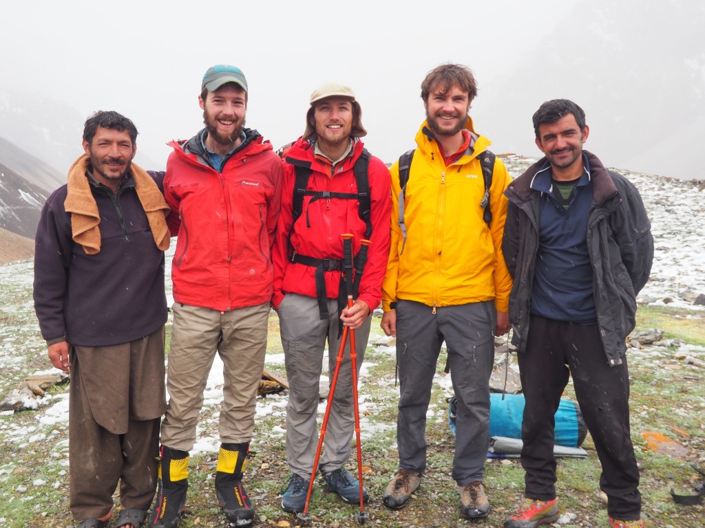
Tim Seers (25) is a junior Doctor now living in Manchester having recently graduated from Imperial College London. He had previously spent three seasons climbing in the European Alps in the summer climbing up to about D+. He has also climbed in Scotland for the last 4 winters up to V, 5 as well as rock climbing throughout the UK and throughout Europe up to HVS. Tim led the expedition and also acted as expedition medic.
James Lawson (27) has recently graduated with a PhD from Imperial College London and is now a postdoctoral research assistant living in London working on power electronics for various applications. James has spent four summers and some time over the last winter in the European Alps climbing up to TD+. He has also climbed throughout the UK up to E1 and in Scotland in the winter up to IV,5. He has recently enjoyed running in several UK mountain marathons with Tim.
Will Smith (24) is a Control Systems Engineer working at a national laboratory near Liverpool. Will has spent 4 summers in the French Alps climbing up to D-, as well as a number of years in Scotland in winter up to IV 4 and throughout UK and Europe climbing up to E1. He is now a member of Liverpool University Mountaineering Club. All three members of the team met while studying at Imperial College London and helped to run Imperial College Mountaineering Club.
Background on Boesam Pass
Boesam Pass lies just to the north of Shimshal in the Karakorum. It is visited by herdsmen and occasional trekkers, both foreign and domestic, but has rarely been visited by climbing parties. Although Information is scarce on other expeditions we are aware that Pir Peak was summited in the winter of 1999 by the Pakistan Alpine Club, Abdullah Bei and Francois Carrel made presumed first accents of peaks immediately North West and north east of the pass in 2005 and in 2011 Mirza Ali and his sister Samina Baig summited Koh-E-Brobar.
The pass is easy to access, taking two days to walk up from Shimshal with a convenient hut located at the halfway point. A basecamp can be made on a fairly flat pasture just on the southern side of the pass with plentiful running water. We found that the best maps covering the area were the Soviet Military Maps Handily we found it was possible to download these onto our phone with an app that included GPS location (Soviet Military Maps Pro). The location of our basecamp and the summits we attempted for reference is shown below. The Swiss Alpine Club map, although popular in the region, lacked sufficient detail for climbing.
Routes Attempted
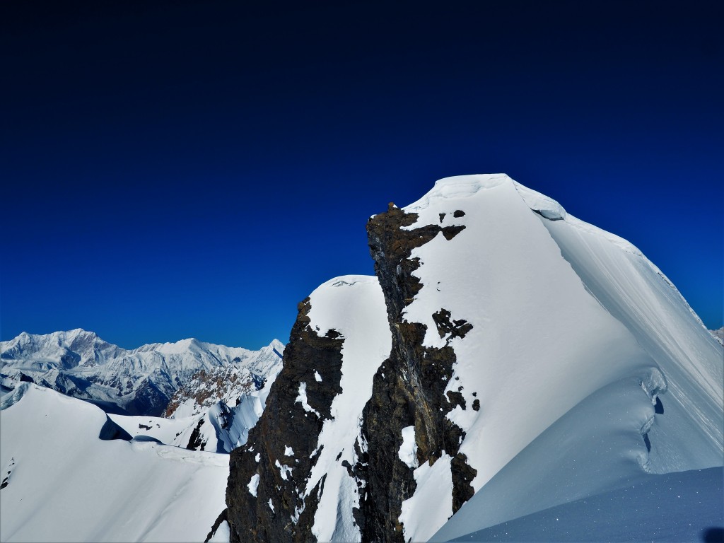
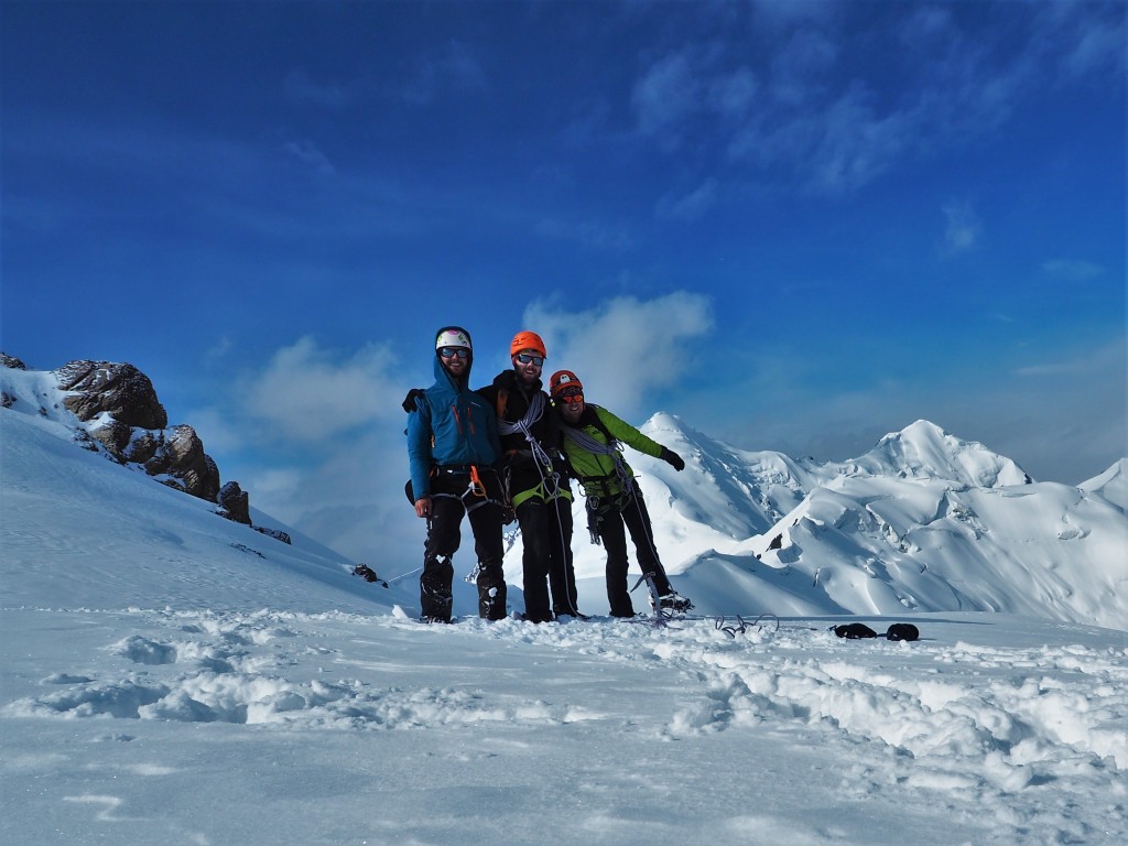
Below is a list of the 7 routes we attempted and pictures. In total we believe we made 5 first ascents. All heights and locations were taken with a GPS unless stated otherwise. We had good weather for all of our attempts. However, snow conditions were in general less favourable. We found a hard crust with deep poorly consolidated snow underneath on every route which made for slow progress at times. We named two peaks that we summited after Imtiaz and Arman, our local guide and cook respectively who were a huge asset to the trip.

Fig 1. A map showing the locations of the summits attempted as well as basecamps and bivouacs. G shows Koh-E-Brobar which we did not summit, F shows Unnamed peak 3 which we also failed to summit. Shimshal lies to the south.
A – Unnamed Peak 1 at 36.53440°N, 75.36591°E, 5700m, on the East of Boesam Pass. Attempted the south face taking the shoulder above a rocky outcrop. Presumed first ascent by Tim Seers, James Lawson and Will Smith. Climbed in a single push in an alpine style. Summited at 0530 on 8th June 2017 in clear calm conditions. Wind slab at the summit, and a short icy section above the shoulder. Around 500m ascent over about 1.5km average angle 35°, around 45° for short sections near shoulder. Grade PD.

Fig 2. Successful attempt up Unnamed Peak 1 by route shown in red. (A) marks the summit.
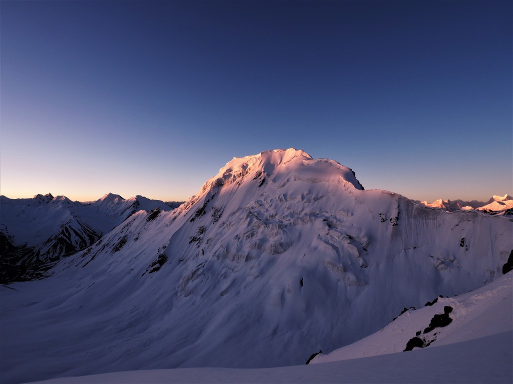
B – Imtiaz Sar at 36.56241°N 75.31744°E, 5930m on the West of Boesam Pass Initially attempted via the ridge at the back of the glacial basin on 9th June 2017 but turned back due to a heavily corniced ridge line, a second attempt on the 18th June 2017 proved more fruitful through the rocks at foot of a long ridge line. Summited at 0545 by Tim Seers, Will Smith and James Lawson having started at 0130 from a camp on the glacier at 5200m (shown in the image below at the intersection of the red and green lines). Route is around 2.5km in length with just under 800m ascent, most of which is in the first half in a gully through the rocks and the first section of the ridge. Up to 55° in sections, with ice in the gully. We had poor conditions on the summit ridge with deep powdery snow under a hard thin crust. Climbed in a single push in an alpine style, grade AD.

Fig 3. An unsuccessful attempt at Imtiaz Sar shown in red and the successful route shown in green. The same colours are used in the map in Fig 1. (B) marks the summit.
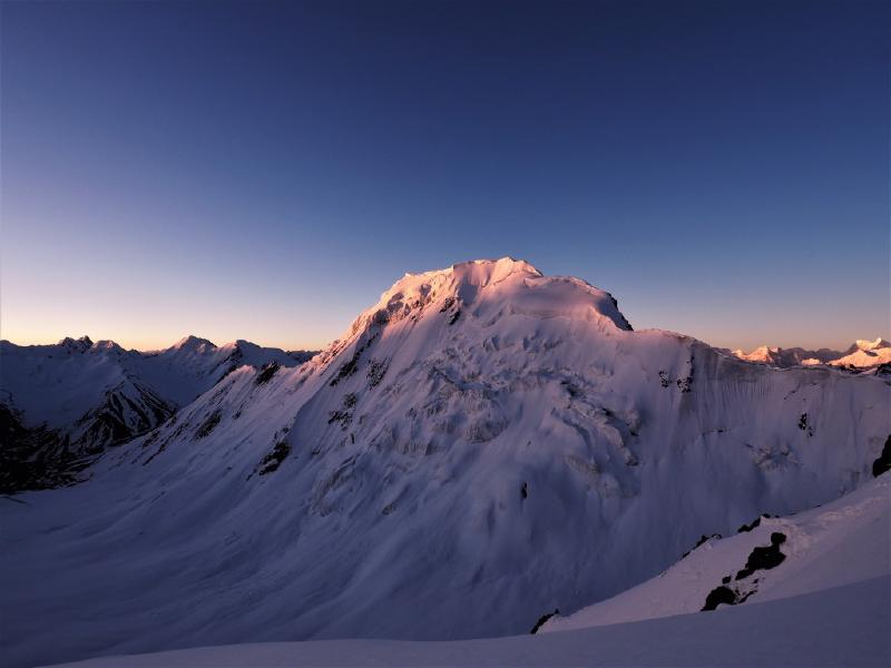
content/post/2017/BoesamExped2017/figures/ C – Koh-e-Brobar at 36.34921°N 75.241121°E, 6008m on the North of Boesam Pass On the 13th June 2017 Tim Seers, James Lawson and Will Smith attempted the summit by the ~3km ridge to the east, a different line to that of Mirza Ali in 2011. We retreated South at the shoulder where Mirza and Samina had made a camp due to very poor snow conditions at 0745 having set off at 0130. The ridge itself was excellent with massive beautiful cornices to negotiate and some rocky pillars in its mid-section. We summited the unnamed subsidiary peak in the middle at 36.55019°N 75.40026°E 5625m, and there is no record of any other parties attempting this line. Grade PD.

Fig 4. An unsuccessful attempt on Koh-E-Brobar (G) took in the peak at (C).
D – Unnamed peak 2 at 36.53891°N 75.34747°E height 5503m Attempted by the North West face by Tim Seers, James Lawson, and Will Smith on the 17th June 2017. We had good conditions at the start of the route which quickly deteriorated near the top of the face, leaving us wading through waist deep snow. Setting off in the dark at 0100 in the hope of colder temperatures we approached the crumbling pile of choss that was the summit at 0530 and, after making an initial attempt turned back about 3m from the summit proper. Climbed in an alpine style in a single push, in places 50°, the route is approximately 600m in length. We descended by the gully slightly to the south. Grade AD.

Fig 5. Unnamed peak 2 is shown at (D). The successful route is shown in red.
E – Arman Sar at 36.57321°N 75.32016°E 5970m Attempted by the prominent eastern ridge by Tim Seers, Will Smith and James Lawson on the 24th June 2017. Setting out at 0030 after a period of slightly warmer weather and wet snow we found a hard crust on the snow between the rocks taking us from the glacier to the ridge proper. After negotiating a steep icy section to make the ridge we passed a series of rocky pinnacles and then continued along the ridge to the ~55° slope at its end. We broke through the first cornice, carried on along a narrow ridge to the second higher peak and then summited at 0730. We descended by the same route, dropping off early to the North having set off a number of avalanches on our way down. Climbed in a single push in an alpine style, approx. 2km, grade AD.
F – Unnamed peak 3 at 36.34515°N 75.19089°E circa 6000m Attempted by the Eastern ridge from the south facing slope by Tim Seers and Will Smith on the 25th June 2017. We moved a camp slightly closer to the start of the route and set off at 1230 in the hope of better conditions. Having quickly made a high point of 5750m by 0230 we turned around due to terrible barely frozen snow. A shame as the ridge looks awesome and the peak is fairly prominent.

Fig 6. Arman Sar is marked with (E) on the left, while Unnamed Peak 3 is shown on the right at (F), estimated to be just over 6000m.
Expedition Log
29th May
Left Acton and headed to Gatwick where we caught a plane to Islamabad.
30th May
Arrived safely in Islamabad and met Ibrar, our representative from ATP. Spent a night in Islamabad and checked out the excellent restaurant next to the hotel called Kabul; worth a visit.
31st May
Flew to Gilgit then drove immediately to Karimabad where we met Amin, our next ATP rep, and Arman, our cook. After picking up our things from the bus they had travelled on from Islamabad we visited Baltit Fort and Amin kindly invited us to his home for lunch. Arman went shopping for supplies and we spent the evening going over what we would take and eat.
1st June
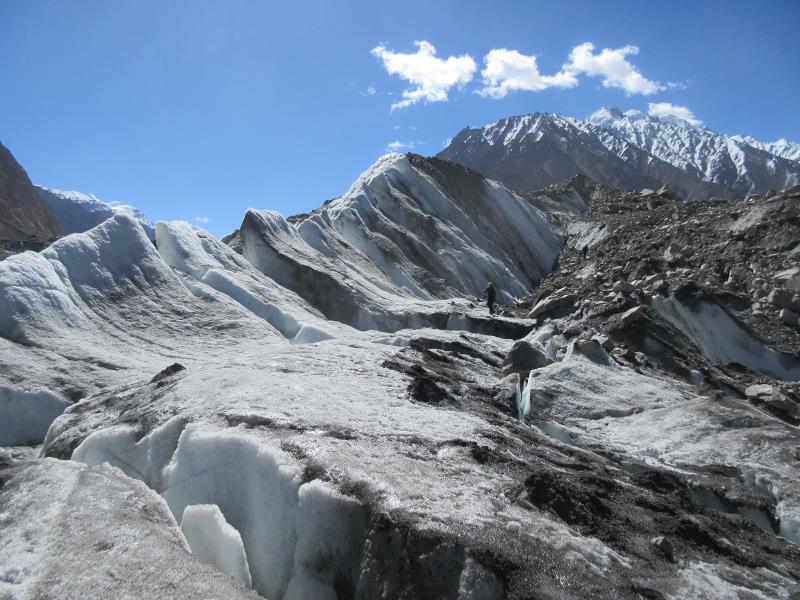
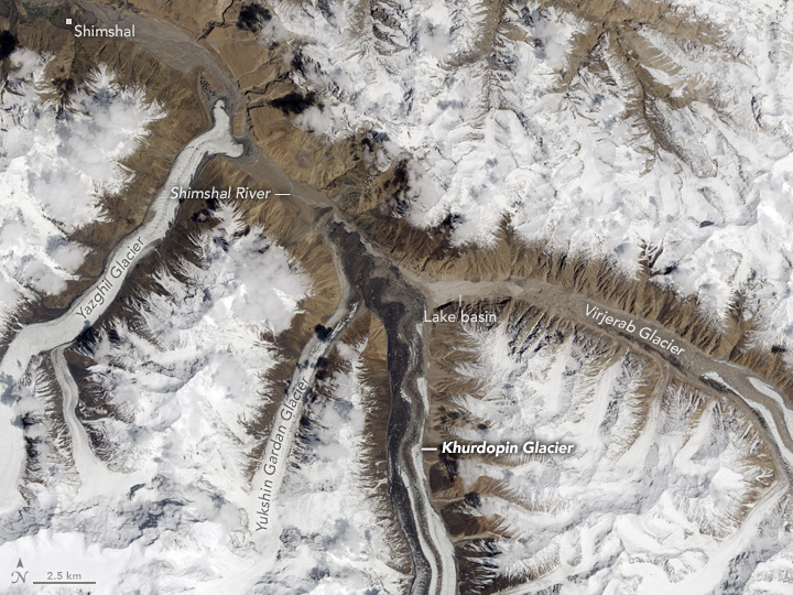
Drove north to Shimshal after hiring Jeeps, Will felt pretty ill. Arrived in Shimshal to meet Imtiaz, our guide for the remainder of the trip. We were told that the Khurdopin glacier had moved and that access to the Virjerab was impossible. Tim and James went with Imtiaz and a porter to investigate.
2nd June
Tim and James return from their unsuccessful attempt to find a way through the Khurdopin Glacier, and after some deliberation and discussion with local guides we make the decision to head north to Boesam Pass and attempt peaks there. Luckily we had maps which covered this area although we had no pictures of peaks and nobody could give us information on what if anything had been attempted before. It seemed like the most sensible option, so we packed everything up and arranged for porters to arrive in the morning. Porters were paid approximately £35 each for carrying 20kg to our basecamp.
For notes on the movement of the Khurdopin glacier see Appendix A
3rd June
Stage 1. 30 porters and 3 donkeys met us in the morning. We walked up the valley from Shimshal and stopped at Samina Beig’s hut next to the football pitch. ~5 hours
4th June
Stage 2. Walked up further up the valley for another 4 hours and stopped for lunch at a shepherd’s hut. It turned out the porters had left all of their sleeping equipment at the previous camp, possibly due to a miscommunication, it wasn’t that clear. While some of them went back to get everything Tim and James went on to scout out a location for the basecamp.
5th June
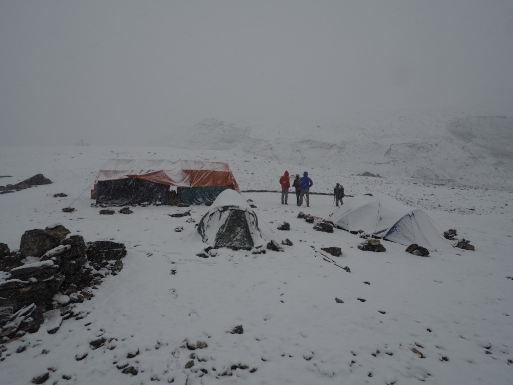
Set up our basecamp at 36.53042N 75.33411E on a plateau just south west of the pass itself.
6th June
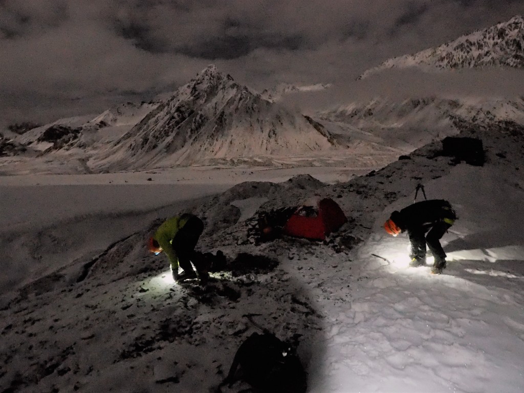
Tim, Will and James carried up a tent, ropes, food and equipment to a camp between the lakes on Boesam Pass at 36.5429N 75.34270E. Weather was terrible with very little visibility; the tent almost blows away as we were putting it up!
7th June
The next morning the weather had cleared slightly and we headed out across the pass with binoculars to scout out potential objectives and get our bearings. We identified a peak that we presumed to be unclimbed to the south of the pass, eyed up a potential line and headed to bed.
8th June
We woke up to a crystal clear morning; the snow had frozen fairly well. After reaching a rocky outcrop halfway up, the slope steeped and became icy. Near the top there was significant wind slab. We tentatively summited at 0530 having set off at 1am. We recorded the height as 5700m and the position 36.53440N 75.36591E and quickly headed back to the ABC.
9th June
Having scanned the map we had we identified a peak marked as P5547 in the basin opposite to the peak we’d climbed the previous day. We got up in the morning at 1am and headed back along the moraine that makes up the edge of the pass and down crossing the glacier and up the other side to the North West. We attempted to gain the summit by heading up the corniced ridge at the back of the basin, but once we were on the ridge it looked far too unstable to attempt so we headed back down, taking note of the other peaks that we could attempt from there.
10th June
Rest at BC
11th June
Rest at BC.
12th June
Headed across the pass and over the glacier on the far side. We set up a camp next to the ridge eventually leading up to Koh-e-Brobar. Our bivi was at 36.55560N 75.37576E at 4947m.
13th June
Woke at 11pm to heavy snow and went back to sleep. Woke again at 0130 to clearing skies and fairly cold temperatures. We headed up the 35-40 degree slope behind the tent till we made the ridgeline. The ridge carried on for around 4km, passing sweeping cornices reminiscent of the Rochefort Arête and some rocky pinnacles which were interesting to get around. We had reached the shoulder at the base of Koh-e-Brobar at 0745 and decided to head down rather than risk getting caught in the increasingly warm snow, a huge slab and sunk beneath us moments earlier. Turning back felt pretty good though, the route up to that point had been amazing.
14th June
Back at BC. Heavy Snow.
15th June
BC. More snow.
16th June
We head up to our original ABC and got ready to attempt the slope behind us to the summit behind the camp.
17th June
A clear and cold night meant we were optimistic as we started up the slope. As we neared the top it got looser and looser and lost time wading in snow that at time was up to our chests. It was hard going but the view from the top ridgeline was breathtaking. We moved together along the slope until we neared the chossy looking summit. Will belayed Tim as he edged up the rocky summit, turning back promptly after finding no gear and it actively falling down (36.53891N 75.34747E 5503m). After descending in warming snow we got back to the ABC at about 0730.
At 1600 we packed up our bivi gear and set out to put a camp in the basin near the basin we’d unsuccessfully attempted the previous week.
18th June
Set off at 0130 under another crystal clear sky and lots of shooting stars. We headed up the easy gully to the north of the bivi and found it to be in good condition with short sections of ~55 ice. The ridge that followed was long and gentle, with a tough slope in the middle. As we went above 5700m the snow deteriorated, it hadn’t consolidated. We summited at 0545 and the weather was perfect so we took a few minutes to take it all in. We got back to the tent at 0730 and back to BC at 1100. James had a letter from his supervisor which ATP had somehow managed to hand deliver to us!
19th June
BC. Snow
20th June
BC. More Snow
21st June
Moved the ABC across Boesam pass to a new location at 36.56601N 75.35483E 5050m. The weather was pretty awful but we were all happy to be out of the BC and doing something.
22nd June
Another day at BC.
23rd June
We headed back to our new ABC and walked slightly up into the valley towards the prominent spur in it’s center. We planned our accent up it’s south side and then heading west along the ridge to the two summits at the top.
24th June
We set off from the ABC at 1am and followed the tracks we’d made the previous day, continuing on to the base of the ridge. A light fog made it hard to see the way up we’d identified the day before. We roped up and headed up a south facing slope. The snow was of poor quality and we had to tread carefully to prevent ourselves from breaking through. After negotiating a steep rocky section we attained the ridge and then passed a number of rocky pillars as the sun rose at about 4am. We continued up the ridgeline with fairly big cornices on our right, eventually making it to the 55° slope at it’s far end. After Will broke through the first cornice we continued along the narrow ridge after the first summit and Tim dug through the second to make the higher of the two summits. We summited at 0715 at 36.57321N 75.32016E and recorded the height from our GPS at 5960m. Turning round fairly quickly we retraced our steps, and a 100m or so after leaving the second steep section the slope avalanched to the right, shearing just 5m in front of us. After deliberating about what to do, we decided to carry on as carefully as we could. We passed more avalanche debris eventually dropping off North about 500m ahead of the point we’d joined the ridge. The three of us returned to the tent at 1015.
In the afternoon Tim and I headed off to set up a bivi beneath the slope to the north of the ridge we’d just climbed. We made a plan to head up this slope and then west along the ridge to the peak we estimated to be slightly higher than the previous day.
25th June
Tim and Will set off from their camp at 1230 at 5300m and headed up the south facing slope to the left of a large slanting buttress. The snow was of fairly poor quality again but we decided to push on to the ridge to see what it was like there. We reached the ridgeline and headed along to a high point of 5750m at 0230 before deciding to turn back as the snow quality was so poor. We got back to the tent at 0330 and after a nap we headed back to the ABC to meet James. The three of us broke the camp at 0930 and headed back to the BC.
26th June
Rest at BC
27th June
With rising night time temperatures and a terrible forecast for the next week we decided to call and end to our climbing attempts and spend the remaining time exploring a nearby valley. We called our porters and arranged for them to come and pick us up on the morning of the 29th June.
After breakfast we headed to Shipedin Pass with Imtiaz. An incredibly chossy path lead up to a snowy pass and a brilliant view.
28th June
We waited for our porters at BC and enjoyed more brilliant food from Arman.
29th June
Met the porters who had brought a huge number of donkeys with them and headed back to Samina Beig’s hut.
30th June
Walked back to Shimshal and went back to the guesthouse.
1st July
Explored the Malenguti Glacier and bivied that evening near a small hamlet at it’s foot.
2nd July
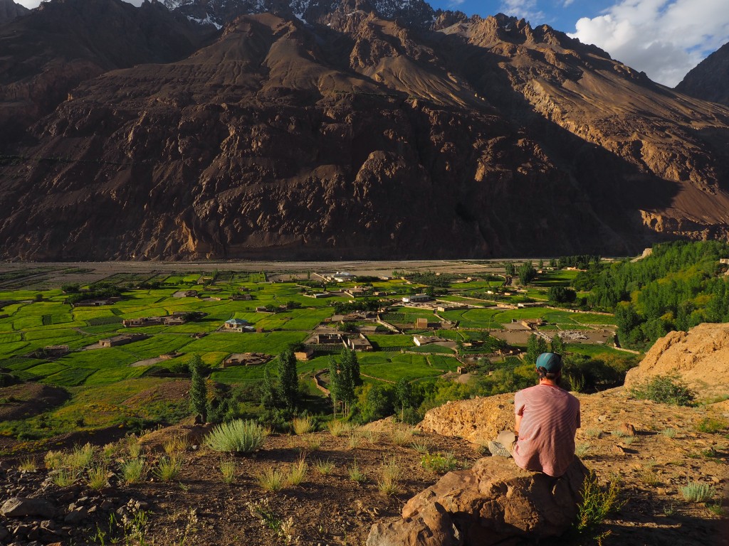
Spent the last day resting in Shimshal and went to Imtiaz’s family home for dinner.
3rd July
Left at 0800 and started the drive back down the valley. Arrived in Karimabad and checked in to our rooms at the hotel.
4th July
Went into Aliabad and got haircuts and a shave and walked back to Karimabad in the afternoon.
5th July
Went to Altit fort in Karimabad and then drove back to Gilgit to stay in a hotel there and wait for our flight the next morning. Met Franz Nodari who had also been on expedition and was heading home with us.
6th July
Flight cancelled so we drove for about 16 hours on the KKH.
7th July
Had a tour of Islamabad with Sami from ATP.
8th July
Flew back to the UK Permits
We initially applied for a trekking permit for the Chapursan Valley and were told by the GBC (Gilgit-Baltistan Council) that we’d need a liaison officer. We agreed to this but were then told that our application had been refused regardless. A week later the GBC had reversed their decision. It’s still unclear whether this area is in the “open zone”. If you are traveling there its worth applying for the permits in good time and having your visas sorted beforehand will probably speed things up. Although applying for a visa without a specific area confirmed is theoretically problematic (according to Gerry’s visa services).
After our initial refusal we changed plans and applied for an NOC (No objection certificate) visit the area around Shimshal. This wasn’t required but ATP thought it wise to make our passage through the area as smooth as possible. Since returning home we’ve read that visitors are now required to have an NOC but the situation seems to change all the time. In any case, it is not possible to arrange for either of these forms without a Gilgit-Baltistan based agent.
Finances
Income
MEF Grant £ 2000 Chris Walker Memorial Trust Grant £ 1000 Imperial College London Exploration Board Grant £ 3000
Totalling £ 6,000
Expenditure
Flights £ 1324 Visas £ 402 Agency Fee £ 468 Transport and Accommodation £ 2142 Porters and Staff £ 3330 Insurance £ 1425 Food and Fuel £ 987 Equipment Hire £ 391 Gas and Hill Food £ 350 Misc (Sat phone etc) £ 300 Equipment Purchase (Boots, sleeping bags etc) £ 2400
Totalling £ 13,521
Balance – Members Contributions
We transferred around £7500 to ATP before we arrived in Pakistan. They handled all of our bookings and most of the food. James acted as treasurer for the duration of the trip. We still had to carry about $500 dollars with us for tips and other misc. items. Dollars are accepted in larger stores everywhere, although people prefer to be paid in Rupees. Insurance
We used the BMC to arrange our insurance which was underwritten by Antares – Syndicate 1274 at Lloyd’s. We had to send additional contingency plans signed by ATP with details of security to get insured for travel on the KKH which is advised against by the FCO (only area surrounding Chilas). Logistics
ATP arranged all of our travel and the movement of our equipment when we arrived in the country. When we flew to Gilgit our bags were sent on the bus. The plane to Gilgit is often canceled, as we found on our return leg. Gas is readily available in Karimabad for stoves (about $7 for a 250g canister). Porters were easy to arrange in Shimshal although we think we benefited enormously from having ATP there to help with the negotiation. We paid just under $50 per porter for them to move a 25 kg load in three stages. Food and Accommodation
We were incredibly happy to have Arman with us on the trip while we were at basecamp. He provided fantastic and massive meals for us three times a day and tea and biscuits whenever we needed. For the climbs themselves we brought with us 15Kg of freeze dried meals from Extreme Foods. These were very tasty but we lacked variety even with 7 options. Accommodation was booked by ATP, but there never seemed to be any trouble in just arriving at a hotel unannounced. Communications
We hired a Thuraya satellite phone from ATP. It didn’t charge and we had to get a replacement which left us without communications for a number of days in the middle of the trip. We neglected to arrange VHF which was a mistake. While all other satellite phones are notionally banned in the country it seems feasible to get one in the country without much hassle. Political and Security Situation
While there were security personnel everywhere we generally felt very safe, certainly as we left Gilgit and headed north. We are not sure why our permit for Chapursan was initially refused but its proximity to the Afghan border probably played a part. Equipment
An excellent guide is found here http://www.alpine-club.org.uk/ac2/eic-equipment. If we were to go again we would have taken some comfy basecamp shoes, a bigger better solar panel and lots more batteries! Medical Arrangements
A comprehensive medical kit should obviously be taken on any expedition traveling to a remote area. We didn’t find any circumstance that wouldn’t have been covered by a routine expedition medical kit. Comprehensive information on pre-trip vaccination can easily be obtained from Fit For Travel. Both the Royal Geographical Societies and the Oxford Handbook of Expedition Medicine are excellent resources. Over the course of the expedition members experienced a number of minor ailments: Firstly diarrhea which was treated with Imodium and codeine when needed, secondly minor wound infection which was treated with flucloxacillin and one incidence of painful breathing probably due to over breathing dry air which was treated with rest and codeine. Photography
There were no photography restrictions in Shimshal or the surrounding area. Some locals had cameras and most people wanted their photos taking! I found John Griffiths guide on mountain photography extremely useful having not really known much before the trip. http://alpineexposures.com/phototips/mountain-photography-tips-part-1 Conclusion
After a bumpy start with our permits being rejected for the Chapursan valley and then finding access to the Virjerab Glacier impossible we were extremely pleased to be able to climb anything, let alone make seven attempts on peaks, some of them unclimbed. The conditions were generally poor and we were forced to climb in the very early hours of the day. Despite this the routes were very enjoyable and there is potential to climb others in the area, the most interesting being unnamed peak 3 (marked F in diagrams in this report), which stands at just over 6000m. Acknowledgements
First we’d like to thank Ben Coope and Tom Wheeler who sadly couldn’t make it on the trip due to injury in the few months leading up to the expedition. Like the rest of us they put a huge amount of effort into planning and training for the trip and it was gutting that they couldn’t come with us. Tom in particular deserves thanks as he acted as our liaison in the UK while we were away relaying messages to our friends and family. Hopefully they’ll be able to come on the next one!
Second we’d like to thank the members of the Imperial College Exploration board, in particular Lorraine Craig and Phil Power. Their help and encouragement in the lead up to the expedition was invaluable and we hope that the board continues to support expeditions of this nature in the future and provide students of Imperial College London with the expertise and information they need to make them happen.
We also need to thank Bruce Normand and Pete Thompson for their advice and contacts. The expedition nearly didn’t happen but Bruce’s encouragement and suggestions meant we managed to re plan our trip a week before we flew from the UK. Pete took the time to call me and offer his help with the huge number of questions I had before we left which was incredibly useful. My biggest piece of advice to anybody considering their first expedition would be to contact people who have been to the area before as soon as possible.
We would also like to thank the many members of the Mount Everest Foundation advisory committee and the Chris Walker Memorial Trust for their invaluable time and support. Extreme Foods for feeding us. ATP for their help, contacts and hospitality. Arman for his cooking, and Imtiaz for his local knowledge and hard work.ICMC and the Exploration Society at Imperial College London for teaching us to climb and getting us excited about alpinism in the first place. Our friends and family for not thinking we were completely mad!
Appendix A - Details of Glacier Movement
Access to the Virjerab glacier from Shimshal was not possible without ice climbing which the porters of Shimshal are not capable of (they only have trainers). The Khurdopin glacier had slipped forwards creating a zone of massive crevasses. Tim and James managed to reach 36.340172N 75.47144E wearing trainers, but at too high risk for porters with heavy loads. Further passage was blocked by a crevasse 3 meters wide and several kilometers long. It was not possible to walk in front of the glacier as a river runs between the glacier nose and the valley wall.
Condition of Khurdopin glacier Interestingly NASA pointed the Landsat 8 satellite at the area on the 13th May 2017 just before we arrived. More details on the so called “Karakorum Anomaly” can be found here: https://www.ukclimbing.com/articles/page.php?id=8106
An image showing the glacier’s progress down the valley taken by NASA Landsat 8 13th May 2017 https://earthobservatory.nasa.gov/IOTD/view.php?id=90672 The location Tim and James turned back is shown in red.